Site Page Aramingo Canal Explore Aramingo Canal: Download Additional Reports The construction of the canal required the Gunner’s Run stream channel to be deepened and straightened, followed by the construction of wooden bulkheads and wharves along its shores. Originally intended to extend more than five miles inland, from the Delaware River to Frankford Creek, only
Historic Sites
Columbia Ave
The Columbia Avenue Site extended from East Columbia Avenue in the south to East Palmer Street in the north. The embankment to I-95 formed the western boundary and North Delaware Avenue formed the eastern boundary. This situation served to constrain the project to a triangular area bounded by the highway, East Columbia, and North Delaware
Dyottville Glass Works Site
Site Page Dyottville Glass Work Explore Dyottville Glass Work: Download Additional Reports The Dyottville study area conditions prior to the start of archaeological investigations were characterized by asphalt paving over Belgian block. Concrete paving related to early-twentieth-century rail lines was exposed beneath the Belgian block in the west half of the excavation area. Sections of
Ellen Street
Site Page Ellen Street Explore Ellen Street: The area was mechanically stripped and hand-excavated. Twentieth-century highway construction disturbed much of the stratigraphy of the site, which generally contained architectural debris directly overlying a natural B horizon. Structural remains of at least five buildings were encountered in the survey area, represented by the remains of approximately
Fishtown 3
Site Page Fishtown 3 Explore Fishtown 3: The excavation of the site was divided in two by a portion of the I-95 highway which has been filled and enclosed within a concrete wall structure. Given this major construction effort through the site, the areas to the north and south of the highway were sampled
Fishtown 4
Site Page Fishtown 4 Explore Fishtown 4: Most of the site is currently under an elevated portion of I-95, which runs roughly east to west through the middle of the site. Given this circumstance, the site was excavated via trenching on either side of the existing highway. North of the highway, intact stratigraphy survived in
Fishtown One Site
Site Page Fishtown 1 Explore Fishtown 1: Site History Summary Urban development on the Fishtown One Site did not really begin until the late colonial era, and even then, the area remained fairly rural. At the time, it formed the southern portion of a large block bounded by the streets now known as Girard Avenue,
Fishtown Two Site
Site Page Fishtown 2 Explore Fishtown 2: At the start of the excavation, the site consisted of bare ground beneath the I-95 viaduct and grass-covered land to the south of the highway between Berks Street and Montgomery Avenue. With the exception of an abandoned trailer at the corner of Berks Street and Delaware Avenue, the
Girard Richmond; Tumanaranaming #2
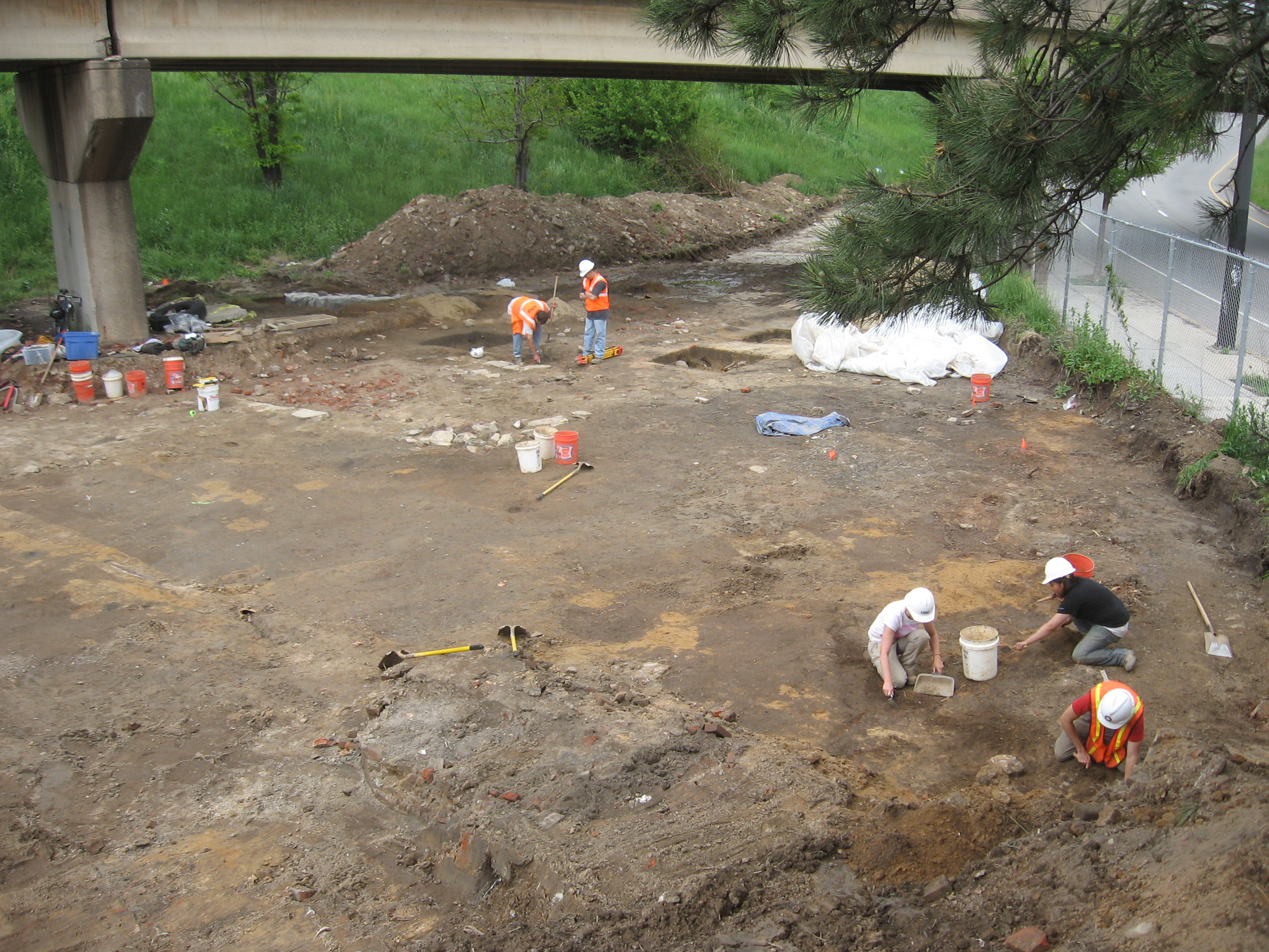
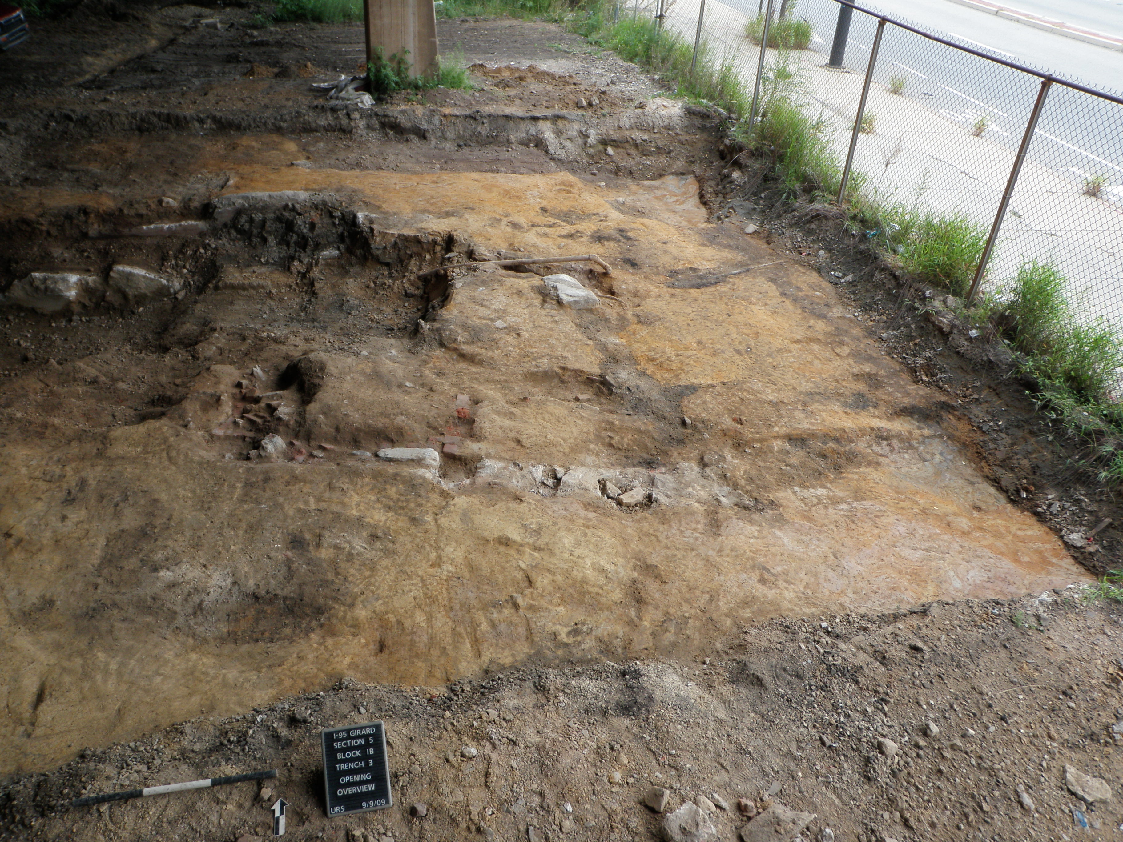
Site Page Girard Richmond Explore Girard Richmond: The site was originally established on a terrace landform overlooking the margins of a nearby stream called Tumanaranaming (“the Wolf’s Walk”) by members of the Lenape tribe, and known during historic times as Gunner’s Run. A steep slope that dropped off into the wetter soils of the floodplain
Gunner’s Run South
Site Page Gunner’s Run South Explore Gunner’s Run South: At the start of the excavation, the site appeared as a combination of bare ground beneath the I-95 viaduct and grass-covered land to the south of the highway. The entire site area was open and featureless, with the exception of a line of small trees along
Hope Farm/Richmond Hall Site
Site Page Hope Farm Explore Hope Farm: Site conditions prior to the start of archaeological investigations were characterized by asphalt pavement over Belgian Block across the eastern two-thirds of the project site, and extending 450 feet north from Cumberland Street. The only above ground structures within this space consisted of an approximately 4.0-foot high concrete
Hunter
Site Page Hunter Explore Hunter: It was first encountered when a large excavation block (Block E) was opened in this area while searching for intact residential backyard spaces. Block E measured approximately 40 feet from north to south by 35 feet from east to west. Due to the potential presence of intact historic soils, two
Northern Liberties 1
Site Page Northern Liberties 1 Explore Northern Liberties 1: An analysis of historic mapping indicated that a proposed stormwater management basin location contained several open backyard areas associated with nineteenth-century residences in the Northern Liberties neighborhood. Machine excavation of the modern overburden revealed multiple historic privies that once served the residents of this busy street
Northern Liberties 2
Site Page Northern Liberties 2 Explore Northern Liberties 2: Prior to excavations, an examination of historic maps was undertaken, revealing that the remains of houses that once lined Second Street are beneath the I-95/I-676 exit ramp—which indicates that this open grassy area spanned several backyards along both Second and Callowhill Streets. Archaeological excavations began with
Northern Liberties 4
Site Page Northern Liberties 4 Explore Northern Liberties 4: In July and August 2015, part of the Northern Liberties 4 Site was subjected to a combination of mechanical stripping and partial feature excavation that revealed a variety of intact historic-period features, including five privy shafts, a fireplace hearth, three foundations, and two stone walls. The
Old City 1
Site Page Old City 1 Explore Old City 1 The Old City 1 Site encompasses roughly the southern third of this area. The northern third of the tested site area sloped steeply down to the south; the remaining southern two-thirds were approximately 10 feet below the current ground level of the neighborhoods to the west.
Old City 2
Site Page Old City 2 Explore Old City 2 The principal areas of ground disturbance for this project took place within the former shoulder and shallow green space embankment along the north side of Race Street, between Second Street and the existing on-ramp to I-95. Within this study area, monitoring was only undertaken in locations
Pegg’s Run North
Site Page Pegg’s Run North Explore Pegg’s Run North: Several historic backyards were located within the bounds of the basin. Specifically, the basin encompasses most of the backyards of the former residences at 122 and 124 Noble Street. Based on previous excavations at other sites investigated within the I-95 project area, several feet of modern
Pegg’s Run South
Site Page Pegg’s Run South Explore Pegg’s Run South: The excavation site was situated within the footprint of a proposed stormwater basin, approximately 250 feet north of Callowhill Street and 450 feet south of the Pegg’s Run North Site. Excavation focused on an area that was formerly Margaretta Street, oriented east-west along the south bank
Port Richmond Site
Site Page Port Richmond Explore Port Richmond: Site History Summary The land the Port Richmond Site occupied was originally part of William Ball’s eighteenth-century estate, and largely remained in his family until the 1840s, when developers acquired much of the block bounded by Richmond, Cambria, Melvale, and Ann Streets. Up to this point, little development
Port Richmond: Cumberland-Huntingdon
Site Page Cumberland-Huntingdon Explore Cumberland-Huntingdon: The project area consisted of the northwestern half of the block fronting on Emery Street. The area was mechanically stripped and hand excavated, revealing truncated B horizon overlain by historic fill and asphalt. Within the site boundary, three trenches were excavated in preliminary exploration of locations with planned construction impacts.
Port Richmond: Huntingdon-Lehigh
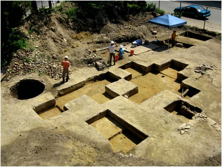
Site Page Huntingdon-Lehigh Explore Huntingdon-Lehigh: In September 2013, the Huntingdon-Lehigh Site was subjected to a combination of shovel testing, mechanically assisted stripping, and the excavation of 18 5-x-5-foot excavation units. The program of archaeological testing identified areas of intact buried A horizon across the site, as well as a variety of intact historic features that
Remer
Site Page Remer/Shackamaxon 1 Explore Remer/Shackamaxon 1: Site History Summary This domestic site is named for the family that occupied this property in the late 1700s and early 1800s. The first member of the family to reside on the site was Matthew Remer (circa 1758–1804). Matthew’s father, Godfrey, immigrated to Philadelphia from Germany in the
Shackamaxon #2 Site
The Shackamaxon #2 Site was initially investigated in 2009–2011, with additional excavations in an associated portion of the site completed in 2014. The site was originally identified at the northeast corner of Columbia and Delaware Avenues, within the Kensington-Fishtown neighborhood; however, subsequent testing demonstrated that parts of the site extended under the highway into ground
Shackamaxon #3
The Shackamaxon #3 Site was originally tested in 2010 and subjected to more intensive documentation in 2013. This pre-contact occupation was identified beneath the I-95 viaduct, in the block bounded by Delaware Avenue, Palmer Street, Salmon Street, and Montgomery Avenue. Like other pre-contact sites in this vicinity, artifacts comprising this occupation were impacted to some