Report 36PH0153 the Archaeological Investigations of the Aramingo/Gunner’s Run Canal
Report 36PH0153 the Archaeological Investigations of the Aramingo/Gunner’s Run Canal
The Pennsylvania Department of Transportation (PennDOT) is undertaking improvements to increase capacity and improve operation and access on Interstate 95 (I-95) between the Vine Street and Girard Avenue Interchanges(Figure 1.1). I-95 currently consists of four lanes in each direction between Vine Street and Girard Avenue. As part of the I-95 Section GIR (I-95/GIR) project, the
Chp. 2
Chp. 4
Chp. 5
Artifact Gallery
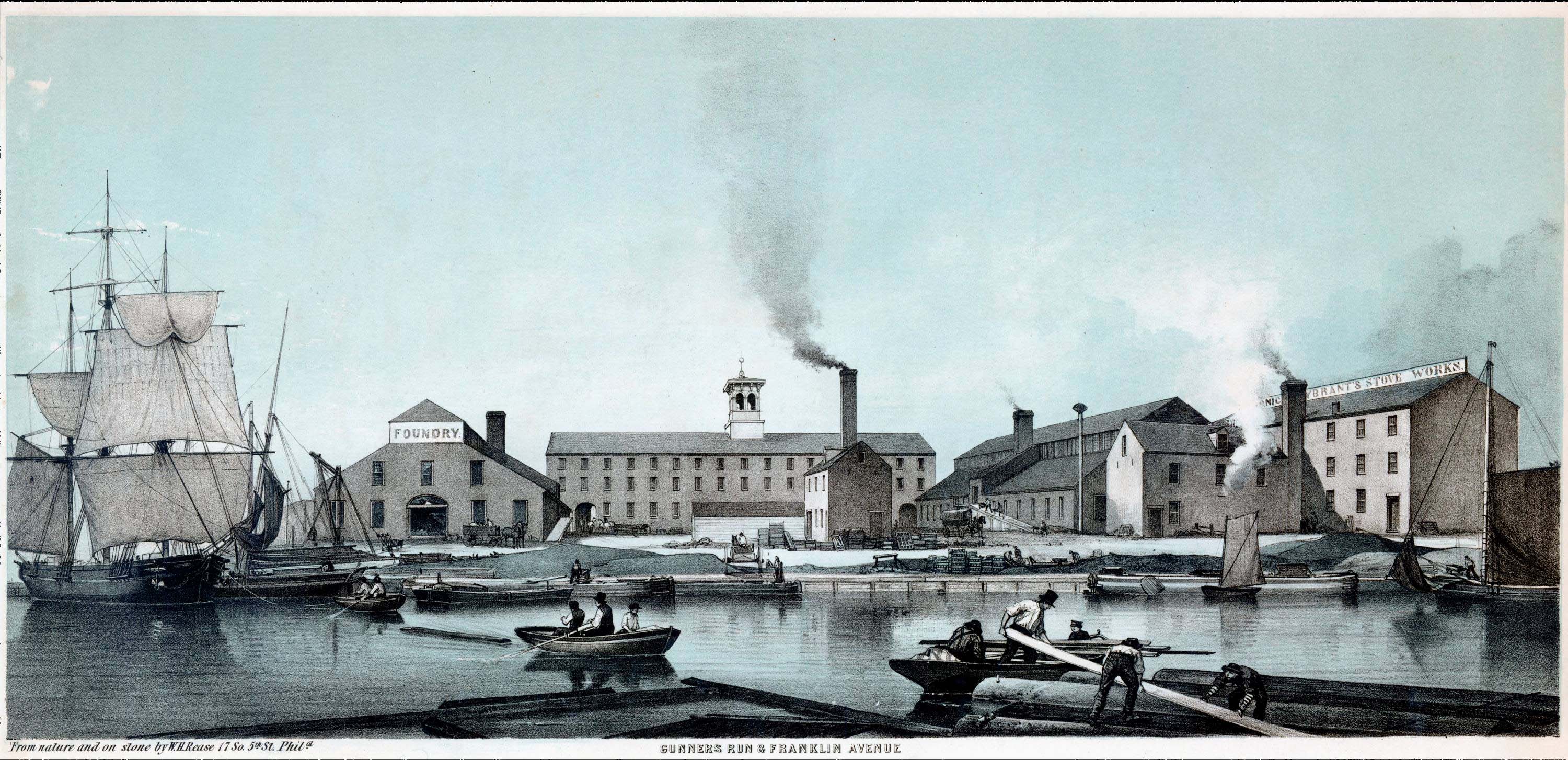
Historic Maps & Figures
Site Page Gunner’s Run South Explore Gunner’s Run South: At the start of the excavation, the site appeared as a combination of bare ground beneath the I-95 viaduct and grass-covered land to the south of the highway. The entire site area was open and featureless, with the exception of a line of small trees along
Appendix A
Appendix B
Appendix C
Appendix D
Appendix E
Appendix F
Appendix G
References