The Shackamaxon #2 Site was initially investigated in 2009–2011, with additional excavations in an associated portion of the site completed in 2014. The site was originally identified at the northeast corner of Columbia and Delaware Avenues, within the Kensington-Fishtown neighborhood; however, subsequent testing demonstrated that parts of the site extended under the highway into ground located to the north of I-95, adjacent to the intersection of Columbia Avenue and Salmon Street. Archaeological investigations yielded more than 1,100 pre-contact artifacts, as well as important environmental data related to the original setting of this occupation.
| Site Name | Shackamaxon #2 |
| PASS# | 36PH163 |
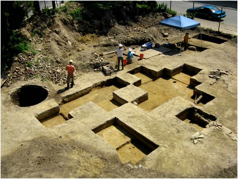
| Image | 1 image site overview |
| Dates of Excavation | 2009-2011, 2014 |
| Phase of Excavation | Phase I, II and III |
| Number of Units | 120 |
| Approximate Number of Features Identified | 0 |
| Associated Periods | Pre-contact: Late Archaic period |
| Site Acreage | Approximately 1.33 acres |
Site History Summary
At the time this site was first occupied by Native Americans sea levels were much lower than they are today, and this location consisted of a gently rolling, forested upland landscape lying perhaps a quarter mile or more from the shores of the Delaware River. The campsite occupied a dry, well-drained rise in the landscape that was bordered to the north by a fairly extensive, low-lying marshy interior wetland that may have also contained a small stream channel.
After the founding of Philadelphia this location remained largely undeveloped until the mid to late 18th century, when the village of Kensington street grid was established and the first residential buildings were constructed along Hanover (now Columbia Ave.) and Queen (Richmond) Streets. Later, during the 19th and 20th centuries crowded lines of row homes and small businesses were built in this vicinity, the former wetland and stream channel were filled in to allow more development, and the Native American site created here thousands of years earlier was gradually surrounded by, and buried within the increasingly complex urban landscape. This location remained a densely built neighborhood until the late 1960s, when all of the buildings here were torn to make way for the construction of I-95.
What Did the Archaeological Excavation Reveal?
The site itself has been partially impacted during historic-period development, with significant portions disturbed by the mid-twentieth-century construction (and subsequent environmental mitigation) of a gas station located at the corner of Allen Street and Columbia Avenue. Eighteenth- and nineteenth-century road, infrastructure, and dwelling construction impacted additional parts of the site, along with the building of I-95 and its associated ramps. Parts of the site that survived historic development were preserved in permanently open yard spaces behind later homes.
Geomorphological assessments of intact site soils determined that Shackamaxon #2 was originally established on a low terrace adjacent to the Delaware River. Undisturbed soils within the site boundaries were sealed beneath a shallow (1- to 1.5-foot-thick) deposit of historic fill, and were well drained and well-suited for human occupation. However, the original ground surface was found to slope down gently to the north, into an area that exhibited soil characteristics associated with having been frequently water-logged. Based on these findings, it was interpreted that the site was created on a slight rise in the terrace adjacent to a wetland or shallow drainage basin that might have also supported a small seasonally intermittent stream.
The artifacts within the site—recovered primarily from slightly truncated plowzone (Ap-horizon) and underlying subsoil (E-horizon) deposits—are dominated by jasper, argillite, chert, quartz, and quartzite tool-manufacturing debris, as well as fire-cracked rock (FCR) from hearths. Tools found within the site include a limited variety of unifacial flake tools (denticulates, scrapers, spokeshaves), as well as a small number of incomplete bifaces and three fragmentary projective points. Other tools include hammer/anvil stones, a reworked celt, and a single pitted cobble.
Spatial analysis of the manufacturing-related artifacts revealed a large concentrated jasper knapping feature, along with peripheral argillite- and quartz-focused activity areas, and it appears that the predominant activity conducted at this site was the making and rejuvenation of stone tools. Although no hearth features were found or carbon-14 samples obtained to more accurately date the site, the morphological characteristics of the recovered points suggest this site was likely occupied during the Terminal Archaic culture period (circa 3000–1000 B.C.).