Explore archaeological sites in the Port Richmond Historic area.
Historic
Neighborhood Map – Northern Liberties
Explore archaeological sites in the Port Richmond Historic area.
Neighborhood Map – Port Richmond
Explore archaeological sites in the Port Richmond Historic area.
Northern Liberties 1
Site Page Northern Liberties 1 Explore Northern Liberties 1: An analysis of historic mapping indicated that a proposed stormwater management basin location contained several open backyard areas associated with nineteenth-century residences in the Northern Liberties neighborhood. Machine excavation of the modern overburden revealed multiple historic privies that once served the residents of this busy street
Northern Liberties 2
Site Page Northern Liberties 2 Explore Northern Liberties 2: Prior to excavations, an examination of historic maps was undertaken, revealing that the remains of houses that once lined Second Street are beneath the I-95/I-676 exit ramp—which indicates that this open grassy area spanned several backyards along both Second and Callowhill Streets. Archaeological excavations began with
Northern Liberties 3
Site Page Northern Liberties 3 Explore Northern Liberties 3: One excavation unit was opened in order to investigate the construction of this street. Dana Street and the excavated foundations are visible on maps from the mid-nineteenth century into the twentieth century, but may date earlier. Due to the presence of surviving structures in the northern
Northern Liberties 4
Site Page Northern Liberties 4 Explore Northern Liberties 4: In July and August 2015, part of the Northern Liberties 4 Site was subjected to a combination of mechanical stripping and partial feature excavation that revealed a variety of intact historic-period features, including five privy shafts, a fireplace hearth, three foundations, and two stone walls. The
Old City 1
Site Page Old City 1 Explore Old City 1 The Old City 1 Site encompasses roughly the southern third of this area. The northern third of the tested site area sloped steeply down to the south; the remaining southern two-thirds were approximately 10 feet below the current ground level of the neighborhoods to the west.
Old City 2
Site Page Old City 2 Explore Old City 2 The principal areas of ground disturbance for this project took place within the former shoulder and shallow green space embankment along the north side of Race Street, between Second Street and the existing on-ramp to I-95. Within this study area, monitoring was only undertaken in locations
Pegg’s Run North
Site Page Pegg’s Run North Explore Pegg’s Run North: Several historic backyards were located within the bounds of the basin. Specifically, the basin encompasses most of the backyards of the former residences at 122 and 124 Noble Street. Based on previous excavations at other sites investigated within the I-95 project area, several feet of modern
Pegg’s Run South
Site Page Pegg’s Run South Explore Pegg’s Run South: The excavation site was situated within the footprint of a proposed stormwater basin, approximately 250 feet north of Callowhill Street and 450 feet south of the Pegg’s Run North Site. Excavation focused on an area that was formerly Margaretta Street, oriented east-west along the south bank
Port Richmond – Gallery
Artifact Gallery Port Richmond The Port Richmond Site (Site Number 36PH0203) is located on the former city block bounded by Richmond, Ann, Melvale, and East Cambria Streets in the Port Richmond section of the city. This historic block now falls within the Conrail Philadelphia property. At the time of the 2010 excavations, the Port Richmond
Port Richmond Site
Site Page Port Richmond Explore Port Richmond: Site History Summary The land the Port Richmond Site occupied was originally part of William Ball’s eighteenth-century estate, and largely remained in his family until the 1840s, when developers acquired much of the block bounded by Richmond, Cambria, Melvale, and Ann Streets. Up to this point, little development
Port Richmond: Cumberland-Huntingdon
Site Page Cumberland-Huntingdon Explore Cumberland-Huntingdon: The project area consisted of the northwestern half of the block fronting on Emery Street. The area was mechanically stripped and hand excavated, revealing truncated B horizon overlain by historic fill and asphalt. Within the site boundary, three trenches were excavated in preliminary exploration of locations with planned construction impacts.
Port Richmond: Huntingdon-Lehigh
Site Page Huntingdon-Lehigh Explore Huntingdon-Lehigh: In September 2013, the Huntingdon-Lehigh Site was subjected to a combination of shovel testing, mechanically assisted stripping, and the excavation of 18 5-x-5-foot excavation units. The program of archaeological testing identified areas of intact buried A horizon across the site, as well as a variety of intact historic features that
Remer
Site Page Remer/Shackamaxon 1 Explore Remer/Shackamaxon 1: Site History Summary This domestic site is named for the family that occupied this property in the late 1700s and early 1800s. The first member of the family to reside on the site was Matthew Remer (circa 1758–1804). Matthew’s father, Godfrey, immigrated to Philadelphia from Germany in the
Remer Site Artifacts – Gallery
Artifact Gallery
Remer Site Excavation – Gallery
Excavation Gallery
Shackamaxon #3
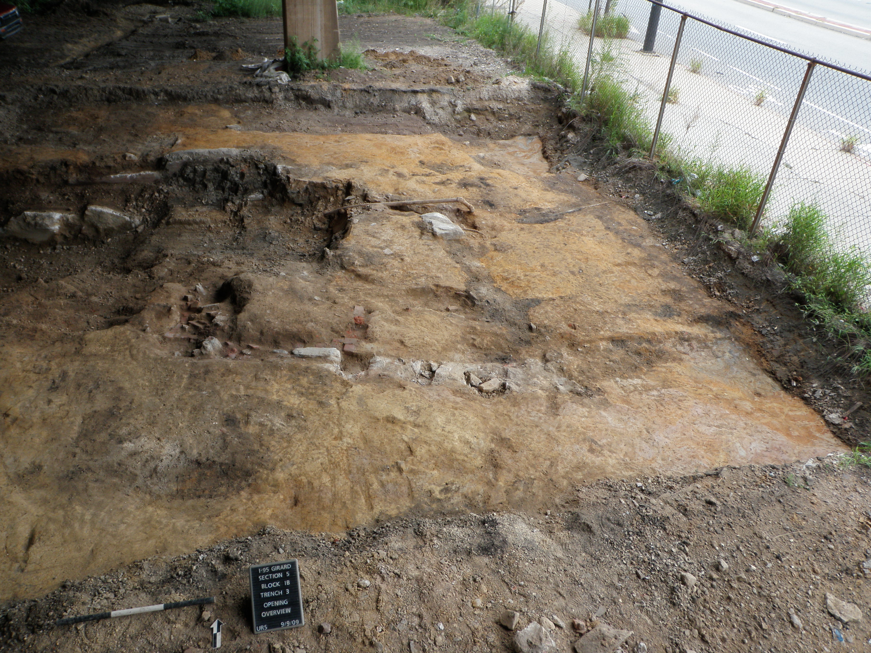
The Shackamaxon #3 Site was originally tested in 2010 and subjected to more intensive documentation in 2013. This pre-contact occupation was identified beneath the I-95 viaduct, in the block bounded by Delaware Avenue, Palmer Street, Salmon Street, and Montgomery Avenue. Like other pre-contact sites in this vicinity, artifacts comprising this occupation were impacted to some
Somerset-Cambria
Site Page Somerset-Cambria Explore Somerset-Cambria: The project area consisted of the eastern half of the block fronting on the former Richmond Street. The area was mechanically stripped and hand excavated, revealing truncated B horizon overlain by historical fill and asphalt. Within the site boundary, six discrete areas were excavated based on planned construction impacts. These