Excavation Site Page
Port Richmond
The Port Richmond Site (Site Number 36PH0203) is located on the former city block bounded by Richmond, Ann, Melvale, and East Cambria Streets in the Port Richmond section of the city. This historic block now falls within the Conrail Philadelphia property. At the time of the 2010 excavations, the Port Richmond Site fell within an overgrown empty lot in the Conrail yard. This lot was bounded on the southwest by East Cambria Street, on the southeast by Melvale Street, on the northeast by Ann Street, and on the northwest by a chain-link fence separating the overgrown lot from a paved parking area under I-95. The property within the Conrail yard had been heavily truncated during the twentieth century, with the ground dropping significantly from the fence eastward into the site. Archaeological excavations were carried out across the entire block through trench testing and monitoring.
Explore
Port Richmond:

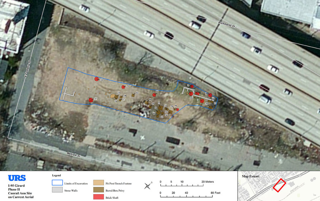
Aerial view of the Port Richmond Site showing the limits of excavation and excavated features
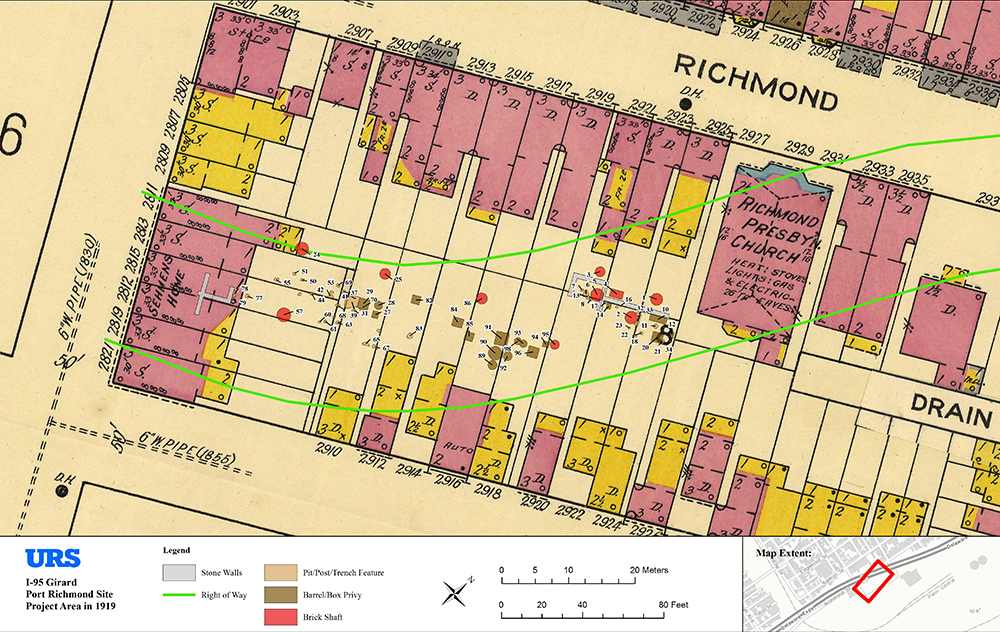
1916 Sanborn Map showing new road alignment, limits of excavation and excavated features.
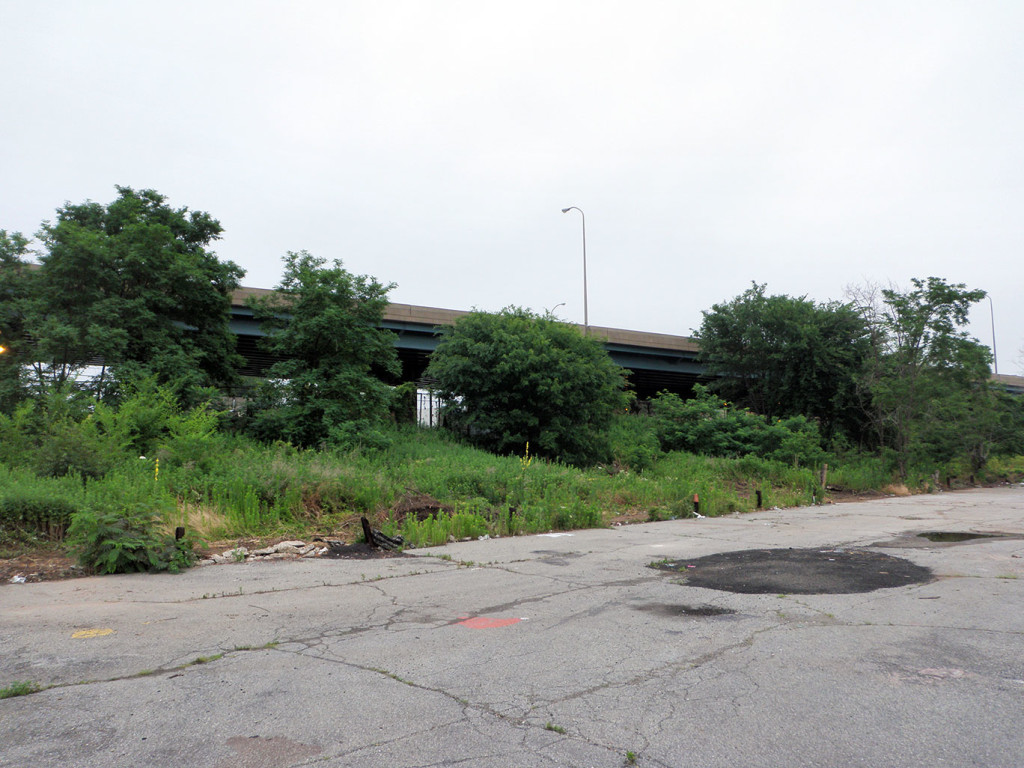
FACING NORTH
The Port Richmond site is located within the block bounded by Richmond Street, Cambria Street, Melvale Avenue, and Ann Street. Phase IB and II investigations were initially undertaken in the area under I-95 (visible in the background) with machine trenching exposing foundations of the Richmond Presbyterian Church, and the remains of a nineteenth and twentieth century brick oven related to a bakery at 2921 Richmond Street both fronting onto Richmond Street. No intact yard deposits were identified in this area. This portion of the investigation did not proceed beyond the test trench phase and will be discussed separately.
FACING NORTH
This view shows the stone building foundation (Structure 1) and section of possible retaining wall (Wall 1).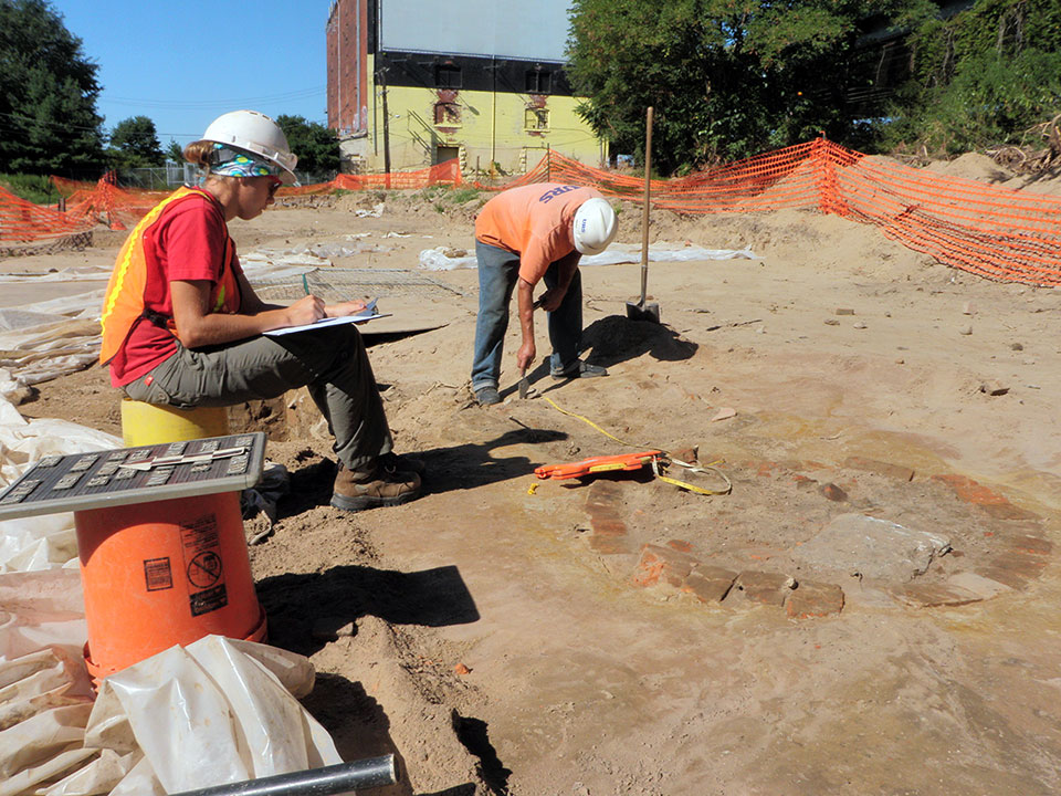
The surviving parallel walls of Structure 1 appear to have been truncated facing the Conrail property, a probable result of rail yard construction in the 1940s.
The A horizon (historic ground surface) had also been removed, also a result of the Conrail yard expansion.
FACING NORTH
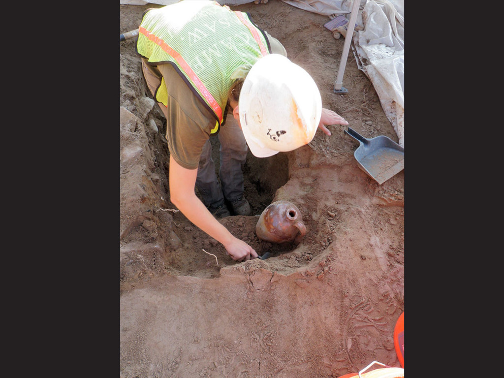
The majority of shaft features were discovered after the overlying fill was removed exposing the remaining below ground portion of the barrel, wood-lined box, or brick shaft.
These structures are visible as circular brick rings or dark soil patches in contrast to the surrounding natural soil. The upper sections of these shafts have been removed when Conrail expanded the rail yard.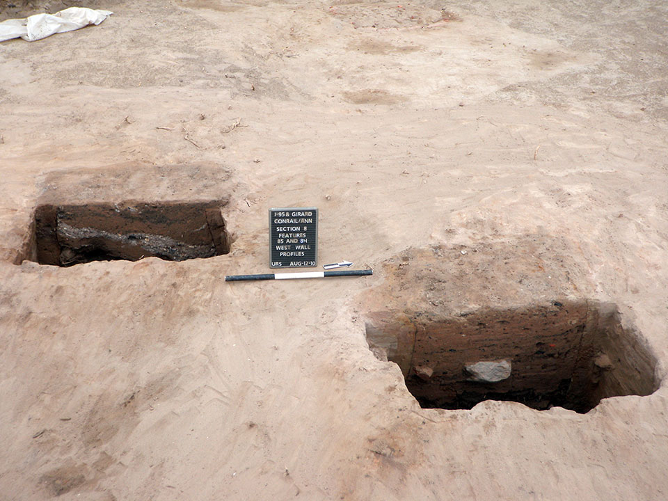
FACING NORTH
Archaeological excavation of these features involved bisecting or excavating one-half to record the soil profile providing information on how the shaft was filled in.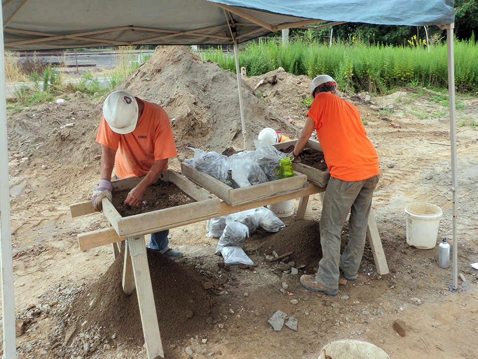
Dating distinct fill deposits is possible based on the types of artifacts recovered from each fill episode. All soil excavated from the privies was screened for the recovery of artifacts.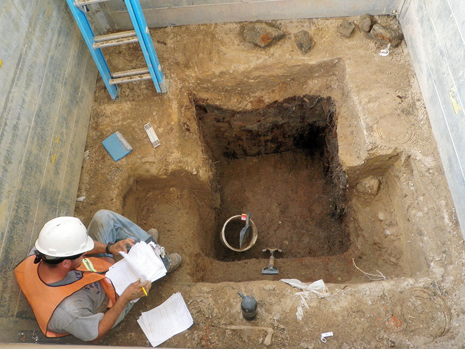
Complete excavation of the shaft features revealed the construction elements of individual privy shafts. This view shows a wood-lined box feature (Feature 20) during excavation of the fill deposits.
The wood plank walls of this shaft are arranged vertically. Wood-box shafts were also lined with horizontal planks and were generally four feet square, although wood-lined box shafts were also rectangular measuring approximately eight feet wide.
No rectangular wood-lined shafts were identified at the Port Richmond site.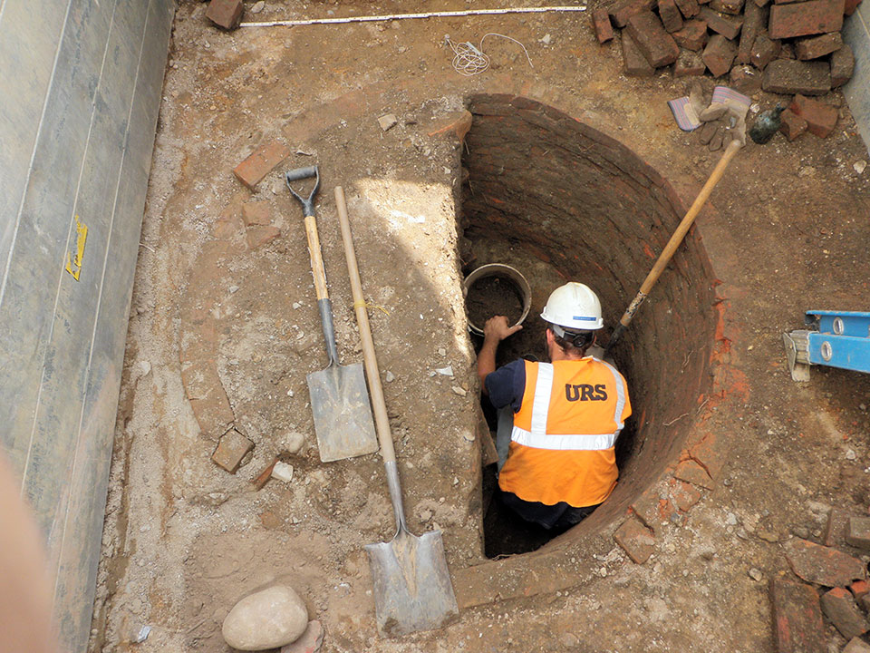
Brick shafts were more structurally sound than wood box or barrel privies and did not have to be replaced. Nine brick shafts were excavated at the Port Richmond site.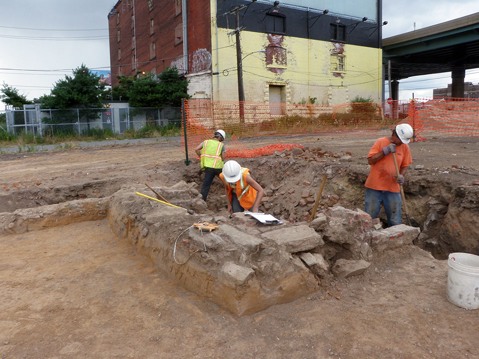
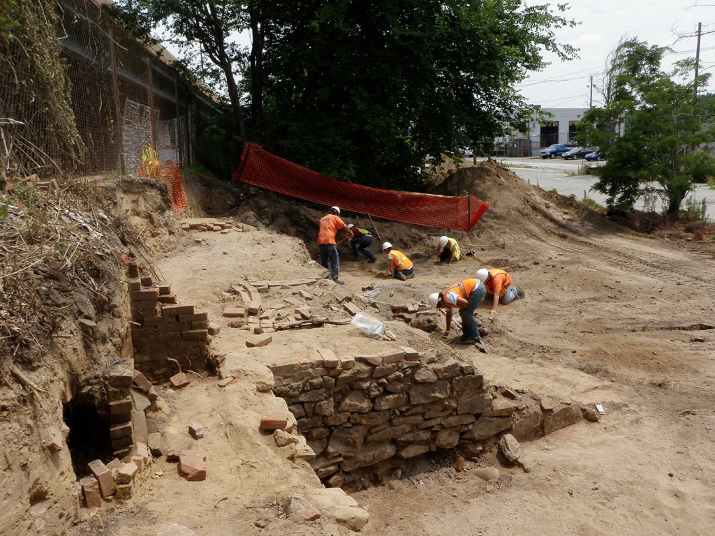
FACING NORTHEAST
Initial clearing of the site involved both machine and hand excavation exposing foundations and shaft features. The Conrail facility is visible in the background. Archaeologists in the foreground are exposing Feature 2, a brick privy shaft located in the rear yard of 2924 Melvale Avenue.
The stone foundations in the foreground (Structure 1, Wall 1) are likely related to a possible stable structure or outbuilding shown on the 1862 Smedley Map and a retaining wall delineating the rear property boundaries between 2922 and 2924 Melvale Avenue and 2923 and 2925 Richmond Street.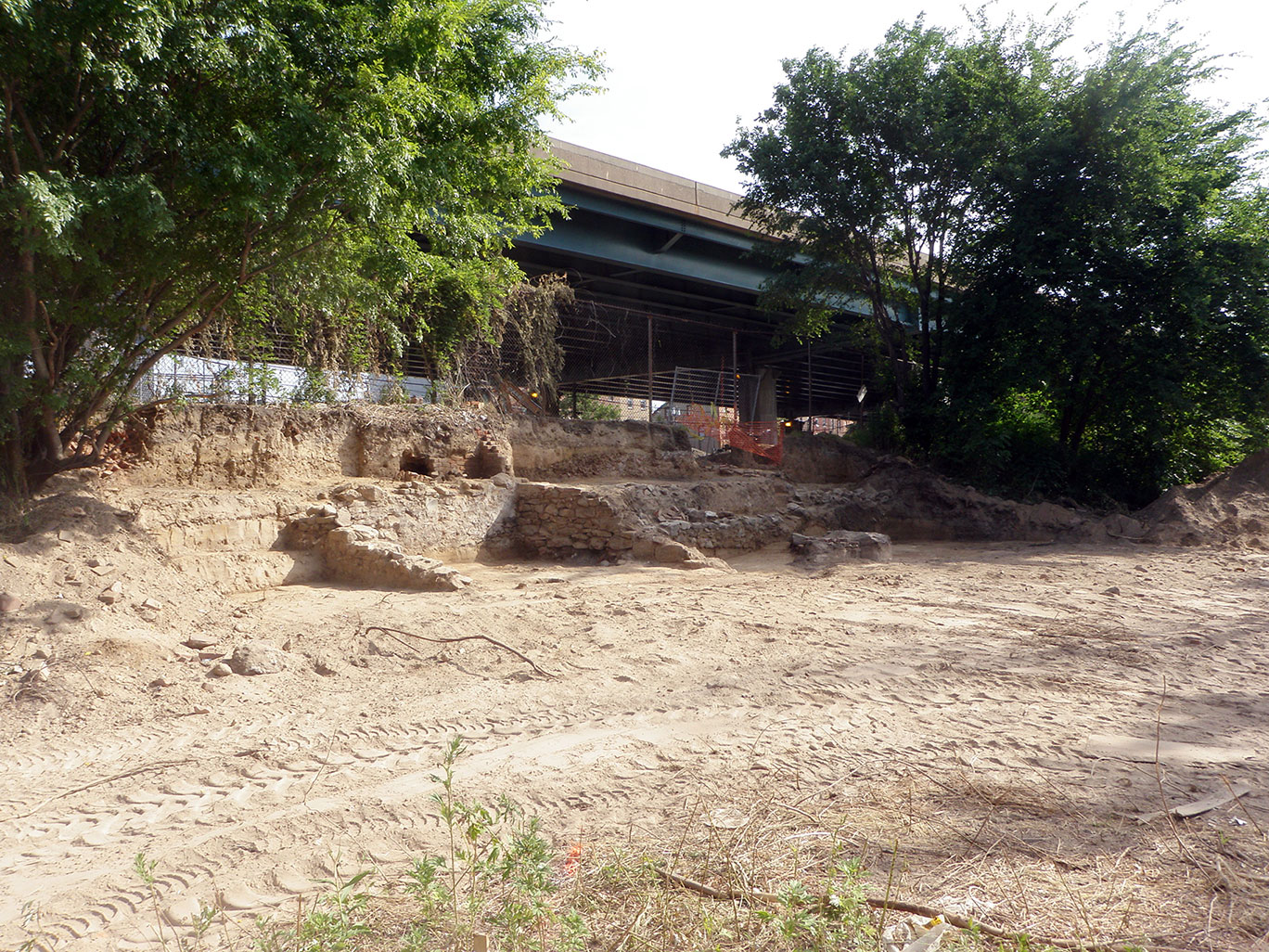
FACING NORTHEAST
A machine trench was excavated to confirm the absence of historic ground surface across the site. This view shows the excavation in progress at the north end of the project site.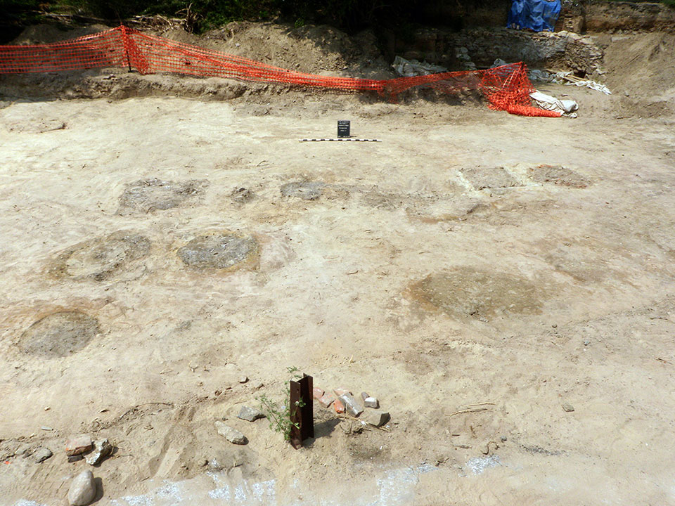
FACING NORTHWEST
The rear walls and basement of the Seamen’s House addition at 2817 and 2815 Cambria Street were identified constructed of mortared stone with concrete stucco on the interior basement walls.

A total of 74 features were identified at the Port Richmond site comprising 30 privy shaft features (10 brick, 9 barrel, 11 wood-box), 14 post holes/molds and 30 pits. Figure 2 shows the extent of features identified across the excavation area during data recovery.
Properties fronting onto Richmond, Cambria, and Melvale Streets were investigated within the new Richmond Street right-of-way comprising approximately one-fourth of the block.
FACING SOUTHEAST
The entire project site was mechanically stripped of fill exposing undisturbed subsoil horizons. The natural A horizon ground surface had previously been removed by rail yard expansion.
The excavation area was confined to the right of way of the realigned Richmond Street. This view shows a section of the mechanically stripped area extending to Cambria Street in the background. A brick privy shaft (Feature 86) is visible in the foreground.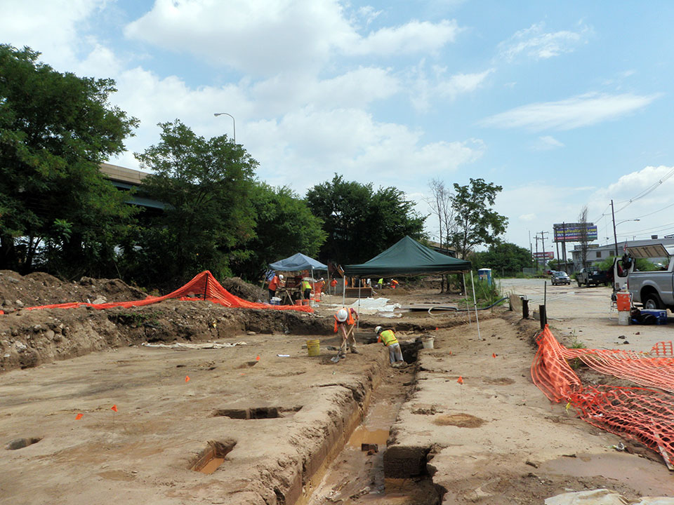
FACING SOUTHWEST
Foundations related to buildings that fronted on Cambria Street were also exposed by machine excavation.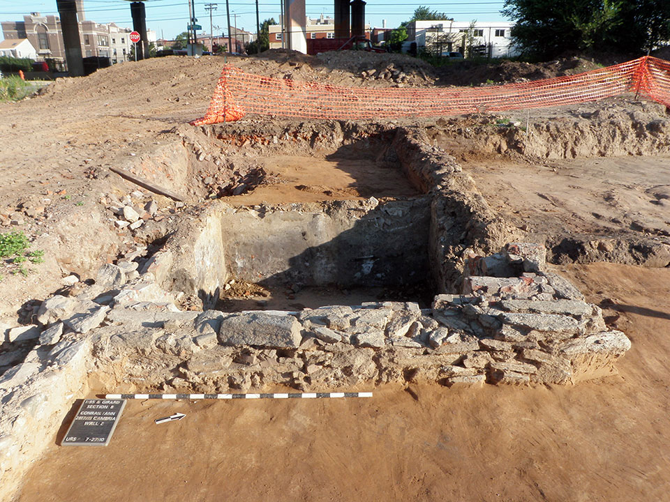
Excavation Site Page
Port Richmond
The Port Richmond Site (Site Number 36PH0203) is located on the former city block bounded by Richmond, Ann, Melvale, and East Cambria Streets in the Port Richmond section of the city. This historic block now falls within the Conrail Philadelphia property. At the time of the 2010 excavations, the Port Richmond Site fell within an overgrown empty lot in the Conrail yard. This lot was bounded on the southwest by East Cambria Street, on the southeast by Melvale Street, on the northeast by Ann Street, and on the northwest by a chain-link fence separating the overgrown lot from a paved parking area under I-95. The property within the Conrail yard had been heavily truncated during the twentieth century, with the ground dropping significantly from the fence eastward into the site. Archaeological excavations were carried out across the entire block through trench testing and monitoring.
Explore
Port Richmond:
Aerial view of the Port Richmond Site showing the limits of excavation and excavated features
1916 Sanborn Map showing new road alignment, limits of excavation and excavated features.
Facing North
The Port Richmond site is located within the block bounded by Richmond Street, Cambria Street, Melvale Avenue, and Ann Street. Phase IB and II investigations were initially undertaken in the area under I-95 (visible in the background) with machine trenching exposing foundations of the Richmond Presbyterian Church, and the remains of a nineteenth and twentieth century brick oven related to a bakery at 2921 Richmond Street both fronting onto Richmond Street. No intact yard deposits were identified in this area. This portion of the investigation did not proceed beyond the test trench phase and will be discussed separately.
Facing Northeast
Initial clearing of the site involved both machine and hand excavation exposing foundations and shaft features. The Conrail facility is visible in the background. Archaeologists in the foreground are exposing Feature 2, a brick privy shaft located in the rear yard of 2924 Melvale Avenue.
The stone foundations in the foreground (Structure 1, Wall 1) are likely related to a possible stable structure or outbuilding shown on the 1862 Smedley Map and a retaining wall delineating the rear property boundaries between 2922 and 2924 Melvale Avenue and 2923 and 2925 Richmond Street.

Facing North
This view shows the stone building foundation (Structure 1) and section of possible retaining wall (Wall 1).
The surviving parallel walls of Structure 1 appear to have been truncated facing the Conrail property, a probable result of rail yard construction in the 1940s.
The A horizon (historic ground surface) had also been removed, also a result of the Conrail yard expansion.
Facing Southeast
The entire project site was mechanically stripped of fill exposing undisturbed subsoil horizons. The natural A horizon ground surface had previously been removed by rail yard expansion.
The excavation area was confined to the right of way of the realigned Richmond Street. This view shows a section of the mechanically stripped area extending to Cambria Street in the background. A brick privy shaft (Feature 86) is visible in the foreground.
Facing Northeast
A machine trench was excavated to confirm the absence of historic ground surface across the site. This view shows the excavation in progress at the north end of the project site.
Facing North
The majority of shaft features were discovered after the overlying fill was removed exposing the remaining below ground portion of the barrel, wood-lined box, or brick shaft.
These structures are visible as circular brick rings or dark soil patches in contrast to the surrounding natural soil. The upper sections of these shafts have been removed when Conrail expanded the rail yard.
Facing North
Archaeological excavation of these features involved bisecting or excavating one-half to record the soil profile providing information on how the shaft was filled in.
Dating distinct fill deposits is possible based on the types of artifacts recovered from each fill episode. All soil excavated from the privies was screened for the recovery of artifacts.
Complete excavation of the shaft features revealed the construction elements of individual privy shafts. This view shows a wood-lined box feature (Feature 20) during excavation of the fill deposits.
The wood plank walls of this shaft are arranged vertically. Wood-box shafts were also lined with horizontal planks and were generally four feet square, although wood-lined box shafts were also rectangular measuring approximately eight feet wide.
No rectangular wood-lined shafts were identified at the Port Richmond site.
Brick shafts were more structurally sound than wood box or barrel privies and did not have to be replaced. Nine brick shafts were excavated at the Port Richmond site.
Facing Southwest
Foundations related to buildings that fronted on Cambria Street were also exposed by machine excavation.
Facing Northwest
The rear walls and basement of the Seamen’s House addition at 2817 and 2815 Cambria Street were identified constructed of mortared stone with concrete stucco on the interior basement walls.
A total of 74 features were identified at the Port Richmond site comprising 30 privy shaft features (10 brick, 9 barrel, 11 wood-box), 14 post holes/molds and 30 pits. Figure 2 shows the extent of features identified across the excavation area during data recovery.
Properties fronting onto Richmond, Cambria, and Melvale Streets were investigated within the new Richmond Street right-of-way comprising approximately one-fourth of the block.
Excavation Site Page
Port Richmond
The Port Richmond Site (Site Number 36PH0203) is located on the former city block bounded by Richmond, Ann, Melvale, and East Cambria Streets in the Port Richmond section of the city. This historic block now falls within the Conrail Philadelphia property. At the time of the 2010 excavations, the Port Richmond Site fell within an overgrown empty lot in the Conrail yard. This lot was bounded on the southwest by East Cambria Street, on the southeast by Melvale Street, on the northeast by Ann Street, and on the northwest by a chain-link fence separating the overgrown lot from a paved parking area under I-95. The property within the Conrail yard had been heavily truncated during the twentieth century, with the ground dropping significantly from the fence eastward into the site. Archaeological excavations were carried out across the entire block through trench testing and monitoring.
Aerial view of the Port Richmond Site showing the limits of excavation and excavated features
1916 Sanborn Map showing new road alignment, limits of excavation and excavated features.
FACING NORTH
The Port Richmond site is located within the block bounded by Richmond Street, Cambria Street, Melvale Avenue, and Ann Street. Phase IB and II investigations were initially undertaken in the area under I-95 (visible in the background) with machine trenching exposing foundations of the Richmond Presbyterian Church, and the remains of a nineteenth and twentieth century brick oven related to a bakery at 2921 Richmond Street both fronting onto Richmond Street. No intact yard deposits were identified in this area. This portion of the investigation did not proceed beyond the test trench phase and will be discussed separately.
FACING NORTH
This view shows the stone building foundation (Structure 1) and section of possible retaining wall (Wall 1).
The surviving parallel walls of Structure 1 appear to have been truncated facing the Conrail property, a probable result of rail yard construction in the 1940s.
The A horizon (historic ground surface) had also been removed, also a result of the Conrail yard expansion.
FACING NORTH
The majority of shaft features were discovered after the overlying fill was removed exposing the remaining below ground portion of the barrel, wood-lined box, or brick shaft.
These structures are visible as circular brick rings or dark soil patches in contrast to the surrounding natural soil. The upper sections of these shafts have been removed when Conrail expanded the rail yard.
FACING NORTH
Archaeological excavation of these features involved bisecting or excavating one-half to record the soil profile providing information on how the shaft was filled in.
Dating distinct fill deposits is possible based on the types of artifacts recovered from each fill episode. All soil excavated from the privies was screened for the recovery of artifacts.
Complete excavation of the shaft features revealed the construction elements of individual privy shafts. This view shows a wood-lined box feature (Feature 20) during excavation of the fill deposits.
The wood plank walls of this shaft are arranged vertically. Wood-box shafts were also lined with horizontal planks and were generally four feet square, although wood-lined box shafts were also rectangular measuring approximately eight feet wide.
No rectangular wood-lined shafts were identified at the Port Richmond site.
Brick shafts were more structurally sound than wood box or barrel privies and did not have to be replaced. Nine brick shafts were excavated at the Port Richmond site.
FACING NORTHEAST
Initial clearing of the site involved both machine and hand excavation exposing foundations and shaft features. The Conrail facility is visible in the background. Archaeologists in the foreground are exposing Feature 2, a brick privy shaft located in the rear yard of 2924 Melvale Avenue.
The stone foundations in the foreground (Structure 1, Wall 1) are likely related to a possible stable structure or outbuilding shown on the 1862 Smedley Map and a retaining wall delineating the rear property boundaries between 2922 and 2924 Melvale Avenue and 2923 and 2925 Richmond Street.
FACING NORTHEAST
A machine trench was excavated to confirm the absence of historic ground surface across the site. This view shows the excavation in progress at the north end of the project site.
FACING NORTHWEST
The rear walls and basement of the Seamen’s House addition at 2817 and 2815 Cambria Street were identified constructed of mortared stone with concrete stucco on the interior basement walls.
A total of 74 features were identified at the Port Richmond site comprising 30 privy shaft features (10 brick, 9 barrel, 11 wood-box), 14 post holes/molds and 30 pits. Figure 2 shows the extent of features identified across the excavation area during data recovery.
Properties fronting onto Richmond, Cambria, and Melvale Streets were investigated within the new Richmond Street right-of-way comprising approximately one-fourth of the block.
FACING SOUTHEAST
The entire project site was mechanically stripped of fill exposing undisturbed subsoil horizons. The natural A horizon ground surface had previously been removed by rail yard expansion.
The excavation area was confined to the right of way of the realigned Richmond Street. This view shows a section of the mechanically stripped area extending to Cambria Street in the background. A brick privy shaft (Feature 86) is visible in the foreground.
FACING SOUTHWEST
Foundations related to buildings that fronted on Cambria Street were also exposed by machine excavation.